What Makes Canyon Country Unique
There is nowhere else on Earth quite like the Colorado Plateau. Roughly 130,000 square miles of high desert spanning Utah, Arizona, Colorado, and New Mexico, this region is the geological stage on which the American Southwest's most iconic landscapes were built - one layer of sediment, one river bend, one million years at a time.
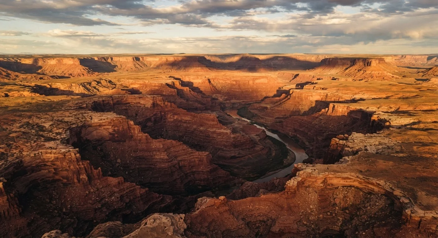
The canyons here are the product of two forces working in slow, relentless partnership: uplift and erosion. Around 70 million years ago, tectonic forces began pushing the plateau upward. The Colorado River and its tributaries, given new gradient to work with, cut downward through layer upon layer of ancient seafloor, desert dune, and river delta - each stratum a different color, a different age. The result is a landscape that functions as a visual timeline of Earth's own history, readable in the banded walls of every canyon.
Colorado Plateau
A large, elevated tableland in the American Southwest where most canyon country parks are located, formed by ancient rock layers lifted upward over millions of years.
Erosion
The gradual wearing away of rock and soil by water, wind, and ice - the primary process that carved the region's canyons over geological time.
Hoodoo
A tall, thin spire of rock left standing after softer surrounding rock erodes away, most famously seen at Bryce Canyon.
Flash Flood
A sudden, rapid flood caused by heavy rain - often far upstream - that can surge through a narrow canyon with little or no warning, posing serious danger to hikers.
Slot Canyon
An extremely narrow canyon with high walls, carved by rushing floodwater through sandstone; beautiful but hazardous during rainstorms due to flash flood risk.
Monsoon Season
A seasonal weather pattern that brings daily afternoon and evening thunderstorms to the Southwest, typically from mid-July through September.
For first-time visitors, understanding this basic geology transforms what might look like a dramatic but abstract scenery into something that rewards sustained attention. When you stand on the South Rim of the Grand Canyon and realize the black rock at the very bottom is nearly two billion years old, or that the red Navajo Sandstone forming Zion's soaring walls was once a Sahara-scale dune field, the landscape stops being a postcard and starts being a story.
The Major Canyon Destinations at a Glance
Canyon country is not a single place but a constellation of parks, monuments, and tribal lands, each with its own character. Knowing what distinguishes them helps you decide where your particular interests and timeframe fit best.
- Grand Canyon National Park (Arizona): The most visited and most recognizable, with the South Rim accessible year-round and the more remote North Rim open roughly mid-May through mid-November. The sheer scale - a mile deep, up to 18 miles wide - can be genuinely disorienting in the best way.
- Zion National Park (Utah): Known for its towering sandstone walls and the famous Narrows hike through the Virgin River. It receives enormous visitor numbers; the park operates a mandatory shuttle system within the main canyon to manage congestion.
- Bryce Canyon National Park (Utah): Technically an amphitheater rather than a true canyon, Bryce is defined by its hoodoos - spindly rock spires formed by frost erosion. Its higher elevation (around 8,000-9,000 feet) makes it cooler than lower canyon parks.
- Arches and Canyonlands National Parks (Utah): Arches is compact and startlingly concentrated with natural stone arches. Canyonlands, just down the road but vastly less visited, offers true wilderness scale and the dramatic confluence of the Green and Colorado rivers.
- Monument Valley Navajo Tribal Park (Arizona/Utah border): Managed by the Navajo Nation, not the National Park Service, Monument Valley operates under different rules - guided tours into the valley floor are required and support the local Diné community directly.
If you're drawn to lesser-explored American landscapes, note that canyon country also includes lesser-visited monuments - Grand Staircase-Escalante, Bears Ears, Vermilion Cliffs - that reward travelers willing to research unpaved roads and solitude.
Reading the Seasons: When to Visit
Timing shapes the canyon experience more profoundly than almost any other planning decision. The region's high desert climate means temperatures swing dramatically between seasons and even between canyon floor and rim.
Spring (March-May) is widely considered the sweet spot. Wildflowers appear on canyon rims, temperatures at lower elevations are manageable, and crowds, while growing, haven't reached summer peaks. Snow can linger on high-elevation rims into April.
Summer (June-August) brings the harshest conditions at low elevations - canyon floor temperatures can exceed 110°F - but also the dramatic monsoon season, when afternoon thunderstorms roll in daily from mid-July through September. Flash flooding is a genuine risk in slot canyons; always check weather upstream, not just at your location. The article What People Get Wrong About Visiting National Parks in Summer covers summer crowd dynamics in more detail.
Shoulder Season Is the Local's Secret
Park rangers and veteran canyon visitors consistently favor late September through October as the single best window to visit most canyon parks. Temperatures are comfortable, the summer crowds have thinned, and the afternoon light takes on a warmth that photographers specifically seek out. If your schedule has any flexibility, aim for this window over the peak summer months.
Fall (September-November) mirrors spring in appeal, with the added drama of cottonwood trees turning gold along canyon bottoms. October is especially popular.
Winter (December-February) is the quietest season. Ice makes some trails hazardous, certain services close, and the North Rim of the Grand Canyon shuts entirely. But winter light is extraordinary - low sun angles paint canyon walls in colors that summer's harsh overhead light flattens - and popular viewpoints can feel almost private.
Logistics, Safety, and Getting Around
The distances in canyon country are genuinely large, and the infrastructure outside of park hubs is thin. Driving is the dominant mode of travel, with the closest major airport hubs being Las Vegas, Phoenix, Salt Lake City, and Denver, depending on which cluster of parks anchors your trip.
A few logistics realities that catch first-timers off guard:
- Cell coverage is sparse. Download offline maps and trail data before leaving any town. Carry a physical map as a backup, and consider a satellite communicator for remote hikes.
- Gas up whenever you can. Stations in canyon country can be 50 to 100 miles apart, and prices at remote outposts are significantly higher than in cities.
- Permits matter. Beyond park entry fees, popular experiences - overnight backpacking, certain day hikes like the Wave at Vermilion Cliffs, river trips - require permits obtained through lottery systems, sometimes months in advance. Check the National Park Service and relevant land management websites well before booking travel.
On safety: desert environments demand respect from even experienced hikers. Heat exhaustion and hyponatremia (overhydration without electrolytes) are both real concerns. The standard guidance from park rangers is to turn around before you feel tired - because you have to make it back. For a thorough pre-departure safety checklist, see our preparation checklist for US desert destinations.
Planning Your First Canyon Country Trip
A first canyon country trip is, for most visitors, the beginning of a longer relationship with this landscape. The practical advice is: don't try to see everything. Attempting to cover the Grand Canyon, Zion, Bryce, Arches, and Canyonlands in a single week means spending most of your time in the car and none of it truly inside the canyons.
A more satisfying approach is to anchor your trip around one or two destinations and give yourself margin to slow down - to sit at a viewpoint as the light changes, to take an unhurried walk rather than a race to the next overlook. Canyon country rewards the patient visitor in ways that a checklist approach simply misses.
National Park Service - Canyon Country Parks
The NPS website provides current entry fees, permit systems, trail conditions, and accessibility information for every national park and monument. It's the authoritative source for planning any canyon country visit.
Recreation.gov
The official federal platform for booking campsites, permits, and timed entry reservations across national parks and public lands. Reservations for popular canyon parks often open months in advance.
US Geological Survey Geology of National Parks
A publicly available educational resource explaining the geology behind major national park landscapes, helping visitors understand the rock layers and forces they're looking at.
Accommodation ranges from in-park lodges (book these far in advance, particularly for the Grand Canyon's South Rim) to gateway towns like Springdale, Utah (Zion's doorstep), Moab, Utah (for Arches and Canyonlands), and Kanab, Utah (a central hub for multiple parks). Camping within parks is deeply available but fills quickly in peak season - again, advance reservations through Recreation.gov are standard practice, not optional.
If this trip marks your introduction to major destination travel more broadly, our guide on planning a trip for the first time offers useful general frameworks for trip research and preparation, even if your destination is domestic. The fundamentals of research, logistics, and managing expectations translate across any big trip.
Canyon country has a way of making visitors recalibrate their sense of scale - of time, of space, of what the land looked like before any of us arrived. That recalibration is worth planning for.