Understanding the Route
The drive from San Francisco to Los Angeles along California's coast is not a single, unbroken highway with one name. It's a patchwork - primarily California State Route 1 (known as Highway 1 or the Pacific Coast Highway), occasionally merging with US-101 through towns where the two-lane coastal road hands off to a wider inland alternative. Knowing this upfront prevents confusion when your navigation app tries to route you inland.
The total driving distance between the two cities by this coastal route is approximately 600 miles, compared with around 380 miles via the faster inland I-5 corridor. That gap represents deliberate detours into some of California's most striking geography: the fog-laced bluffs of Marin County, the redwood-sheltered hamlet of Bodega Bay, the jaw-dropping cliff-edge stretches of Big Sur, and the tawny dunes above Pismo Beach.
~600 mi
Coastal route length, SF to LA
Compared with approximately 380 miles via the inland I-5 - the extra distance is entirely scenic.
4-5 days
Recommended drive duration
Travelers who allow four to five days consistently report a more satisfying experience than those rushing through in two.
1 year+
Big Sur closure after 2017 Mud Creek slide
The 2017 landslide blocked a 70-mile stretch of Highway 1, underscoring how weather events can affect route planning.
It helps to think of the route in three broad segments. The northern stretch runs from San Francisco through Pacifica and Half Moon Bay down to Santa Cruz - suburban at first, then progressively wilder. The central segment winds through Monterey, Carmel, and the Big Sur coast, which is the most dramatic and the most logistically demanding. The southern stretch from San Simeon through San Luis Obispo to Santa Barbara and eventually into the Los Angeles basin is more open, with wider roads and easier services.
Choosing Your Direction and Pacing
Traveling southbound - San Francisco to Los Angeles - is the conventional choice for a simple reason: driving south keeps the ocean on the driver's right side, meaning the water views are closest to your lane and to any passenger in the front seat. Pull-outs and turnoffs are also easier to access without crossing oncoming traffic. That said, northbound travelers report that they feel less rushed because they're going against the tourist grain.
Three days is technically possible, but it compresses every stop into a blur. Most travelers who later say the drive was one of the highlights of their trip spent four to five days, averaging 120 to 150 miles per day. That rhythm leaves room for an unplanned beach walk, a spontaneous lunch in Cambria, or waiting out morning fog for a clear photograph above the water.
Book Big Sur lodging or campground sites at least eight weeks out in summer. Waiting until two weeks before your trip almost guarantees you'll be based much farther away than you'd like.
In-region accommodations are extremely limited relative to demand, and the 30-45 minute drives from nearby towns add up quickly when you're trying to catch sunrise over the cliffs.
Set your daily start time for 1-2 p.m. on fog-heavy stretches if you're traveling in summer - marine fog typically burns off by early afternoon, revealing the views you came for.
Starting the dramatic cliff-side portions of the drive in the afternoon rather than morning dramatically increases the chance of clear, photography-worthy conditions along Big Sur.
Build buffer days into your itinerary if you're traveling between November and April. Highway 1 through Big Sur has a documented history of landslide and storm damage - the 2017 Mud Creek slide closed a 70-mile stretch for more than a year. Before your trip, check Caltrans road condition updates at the official California Department of Transportation website to confirm current accessibility. Before you head out, it's also worth reviewing our vehicle readiness checklist to ensure your car is prepared for the narrow, winding roads ahead.
Key Stops Along the Way
Rather than an exhaustive list, here is a sequenced selection of stops that reward the investment of time:
- Half Moon Bay: A low-key beach town with a working fishing harbor and some of the most accessible tidepools near the Bay Area. It also hosts one of the world's premier big-wave surf spots - Mavericks - visible from shore when swells run.
- Santa Cruz: Home to a historic boardwalk and a surf culture that dates to the early 20th century. The city sits at the top of Monterey Bay and marks the transition from suburban sprawl to genuinely rugged coastline.
- Monterey and Carmel-by-the-Sea: Monterey's Cannery Row, immortalized by John Steinbeck, and the world-class Monterey Bay Aquarium anchor the north side of the bay. Carmel, just south, has a fairy-tale quality - a small town of art galleries, a white-sand beach, and the 18th-century Mission San Carlos Borromeo.
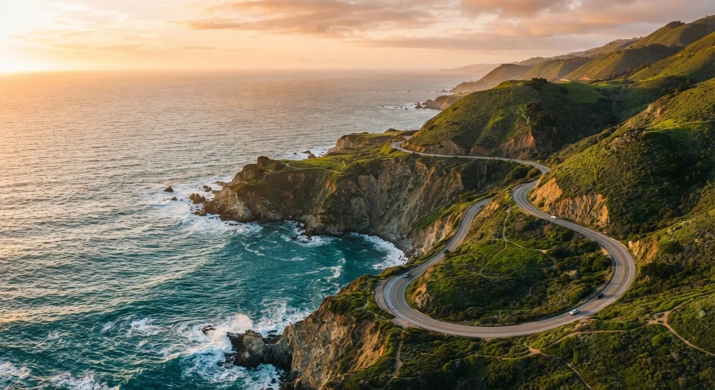
- Big Sur: More of a region than a town, Big Sur is where Highway 1 clings to cliffs several hundred feet above the sea. Bixby Creek Bridge is the most photographed spot on the entire route. Plan for limited fuel options - the last reliable gas is in Carmel.
- Hearst Castle / San Simeon: William Randolph Hearst's hilltop estate is a legitimate historical landmark managed by California State Parks. Tours require advance reservations and are worth scheduling before your trip.
- Santa Barbara: The route rejoins broader roads here. Santa Barbara's Spanish Colonial architecture, palm-lined State Street, and proximity to wine country in the Santa Ynez Valley make it a natural final overnight before the push into Los Angeles.
Seasonal Conditions and When to Go
Summer is the most popular season, but it's not necessarily the most rewarding for the coastal drive. June through early August brings persistent marine fog - locally called the "June Gloom" - that can blanket the coast from San Francisco through Big Sur for most of the morning. Vistas you've been looking forward to may not materialize until early afternoon.
Late September through November is widely considered the sweet spot by those who drive the route regularly. The fog recedes, crowds thin after Labor Day, and the low-angle autumn light gives the cliffs and headlands a warm, golden quality that photographs beautifully. Spring (March through May) is another strong option, when wildflowers bloom on the hillsides and whale migration brings gray whales within sight of the shore.
Winter travel is possible but carries real risk. Storm systems can close sections of Highway 1 with little notice, and some smaller lodging options shut down between January and March. If you're determined to go in winter, have flexible bookings and a contingency route via US-101 in mind.
Practical Logistics to Sort Before You Leave
A few logistical realities shape the experience more than any single stop does:
Fuel: Big Sur has one gas station (at the Lucia area), and it charges accordingly. Fill up in Carmel before heading south, and again in San Simeon when you emerge. Don't assume you can make it on a half-tank.
Connectivity: Cell service is genuinely unreliable through much of Big Sur. Download offline maps through a navigation app before leaving Carmel, and notify anyone who may need to reach you that you'll be off-grid for several hours.
Lodging: Accommodations within Big Sur itself are limited - a handful of campgrounds, a few lodges, and some glamping-style sites. These book weeks or months in advance during peak season. If you can't secure something in-region, Carmel and San Simeon make excellent base camps at either end.
Driving style: The two-lane sections of Highway 1 require focused, patient driving. Speed limits drop to 25-35 mph through the curves, and there's no passing on most cliff-side stretches. Coastal fog can reduce visibility quickly - use headlights and slow down without hesitation. For a broader look at how highway driving demands differ from urban driving, the highway vs. city driving safety guide is worth a read before departure.
Road conditions, entry requirements, and park fees can change. Always verify current information through official Caltrans and California State Parks sources before traveling.